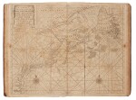

Mount, William, and Thomas Page | "The Courses and Distances from one Place to Another..." — The Navigator's Bible
Auction Closed
November 22, 05:54 PM GTNN
Estimate
20,000 - 30,000 USD
Lot Details
Description
Mount, William, and Thomas Page
The English Pilot. The Fourth Book describings the West-India Navigation, from Hudson's Bay to the River Amazones. London: J. Mount, T. Page, W. Mount, 1780
Folio (478 x 305 mm). 21 engraved full-sheet maps, 4 engraved in-text maps; tissue repair to lower margin of title, browning, foxing, and offsetting, occasional staining, some short splits to folds, one or two instances of restoration to splits. Contemporary calf, early manuscript notes on free endpapers listing names of various contemporary sea captains and their ships; rebacked and recornered, ring-shaped scorch mark to upper board; endpapers torn and restored.
Maps include:
1. "A New and Correct Chart of the North Part of America..." (double-page)
2. "A New Generall Chart for the West Indies" (double-page)
3. "A New and Accurate Chart of the Vast Atlantic or Western Ocean" (double-page, folding)
4. "A Chart of the Sea Coast of New Found Land..." (double-page)
5. "The Harbour of Casco Bay..." (double-page)
6. "A New and Correct chart of the Coast of New-Found-Land" (double-page, folding)
7. "Island of St Peter’s" (in-text)
8. "A Chart of the South-East Coast of Newfoundland" (double-page, folding)
9. "A Map of the Coast of New England..." (double-page, folding)
10. "A Draught of New York..." (double-page)
11. "Virginia, Maryland, Pennsilvania [sic], East & West New Jersey" (double-page, folding)
12. "Barbados" (in-text)
13. "A Draught of Virginia" (double-page)
14. "Antegua [sic]" (in-text)
15. "A New Mapp of the Island of St. Christophers [sic]" (double-page)
16. "A Draught of South Carolina and Georgia..." (double-page, folding)
17. "A Correct Chart of the Caribbee [sic] islands" (double-page)
18. "A Correct Chart of Hispaniola" (double-page, folding)
19. "A Draught of the West End of the Island of Porto [sic] Rico" (double-page, folding)
20. "A New & Correct Chart of Cuba" (double-page, folding)
21. "A New and Correct Draught of the Bay of Matanzas" (in-text)
22. "Bermuda" (in-text)
23. "A New & Correct Chart of the island of Jamaica" (double-page, folding)
24. "A Chart of the Coast of Guayana [sic]" (double-page, folding)
25. "A New and Correct Chart of the Trading Part of the West Indies" (double-page, folding)
"The first significant collects ion of charts exclusively of the American coasts to be published in England" (Cumming 9).
Influenced by the Dutch pilot books of Pieter Goos (see lot 21), the English Pilot series was started by John Seller in 1671. "For British trading in North America and for the colonists there, the publication of The English Pilot: The Fourth Book must have been a godsend. For the first t.mes an English sea atlas presented charts of the whole eastern seacoast of North America. To modern eyes the charts are crude and sparse of detail; but to the navigator of American waters in that period, it was his Bible. Whatever its shortcomings, there was really no substitute, no real competitor, for over sixty years" (Cumming 39).
Perhaps due to its usefulness, 37 editions were published from 1689 to 1794, as were three pirated editions. Over the course of these editions, the charts went through various changes, beginning with the addition to the 18 charts in the first edition to an eventual 26 in the final edition. Verner specifies that 64 different chart titles have been recorded from the editions he examined.
Given its practical nature and use, copies of any edition rare.
REFERENCE:
Verner, Carto-Bibliography of the English Pilot the Fourth Book 33 (a copy of Verner accompanies the lot)
PROVENANCE:
Swann, 6 December 2007, lot 20 (undesignated consignor)
You May Also Like


